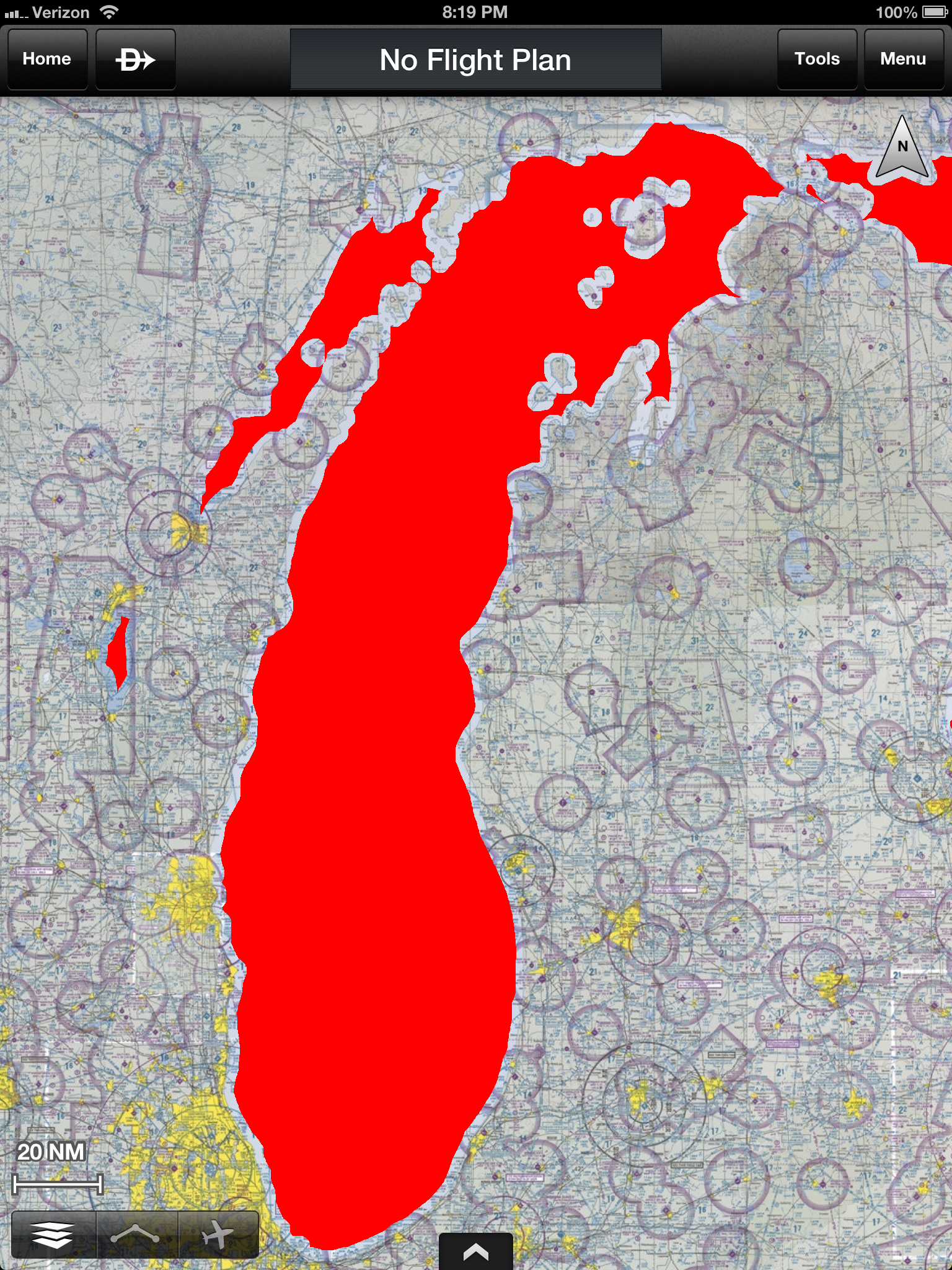
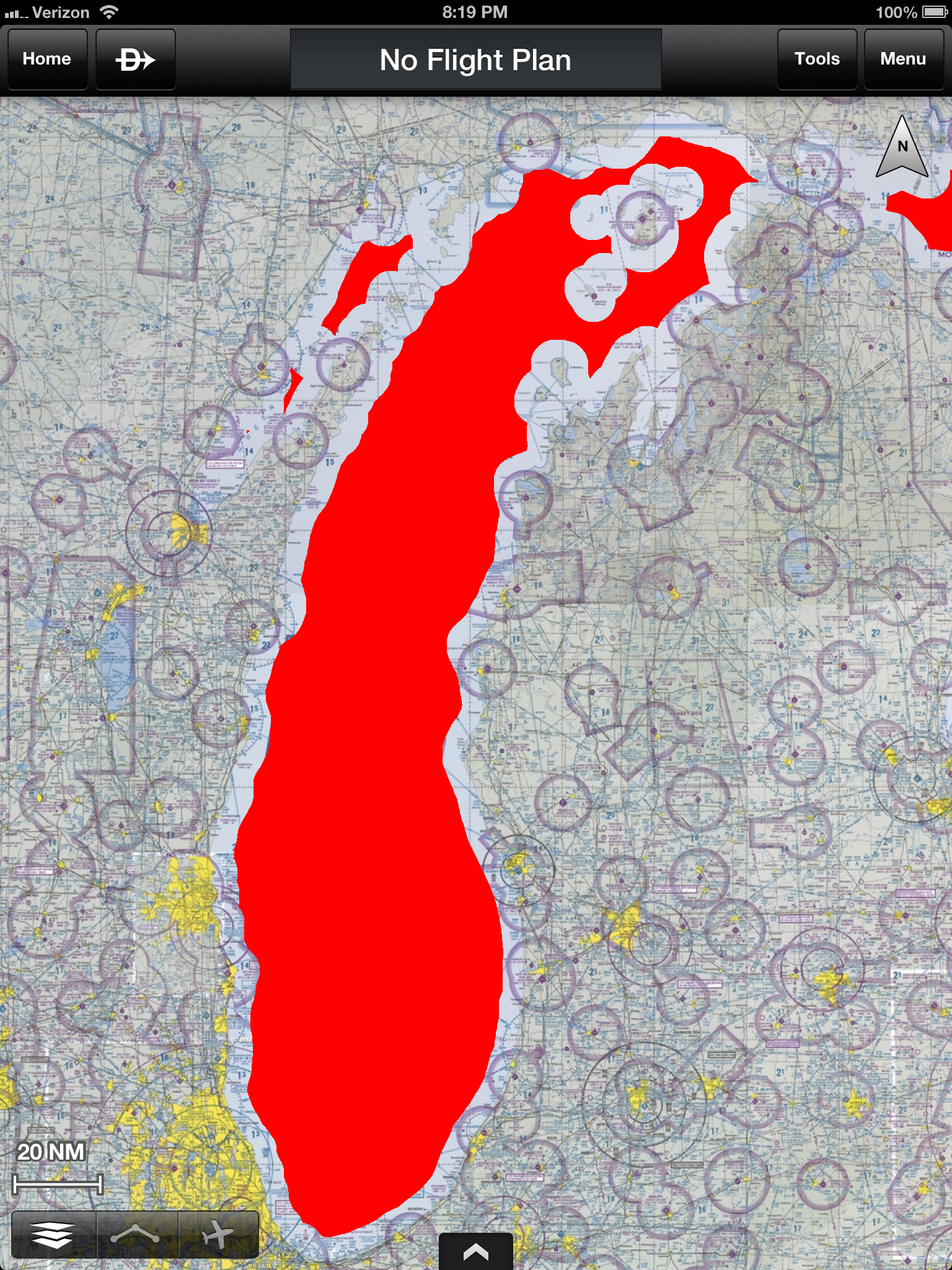
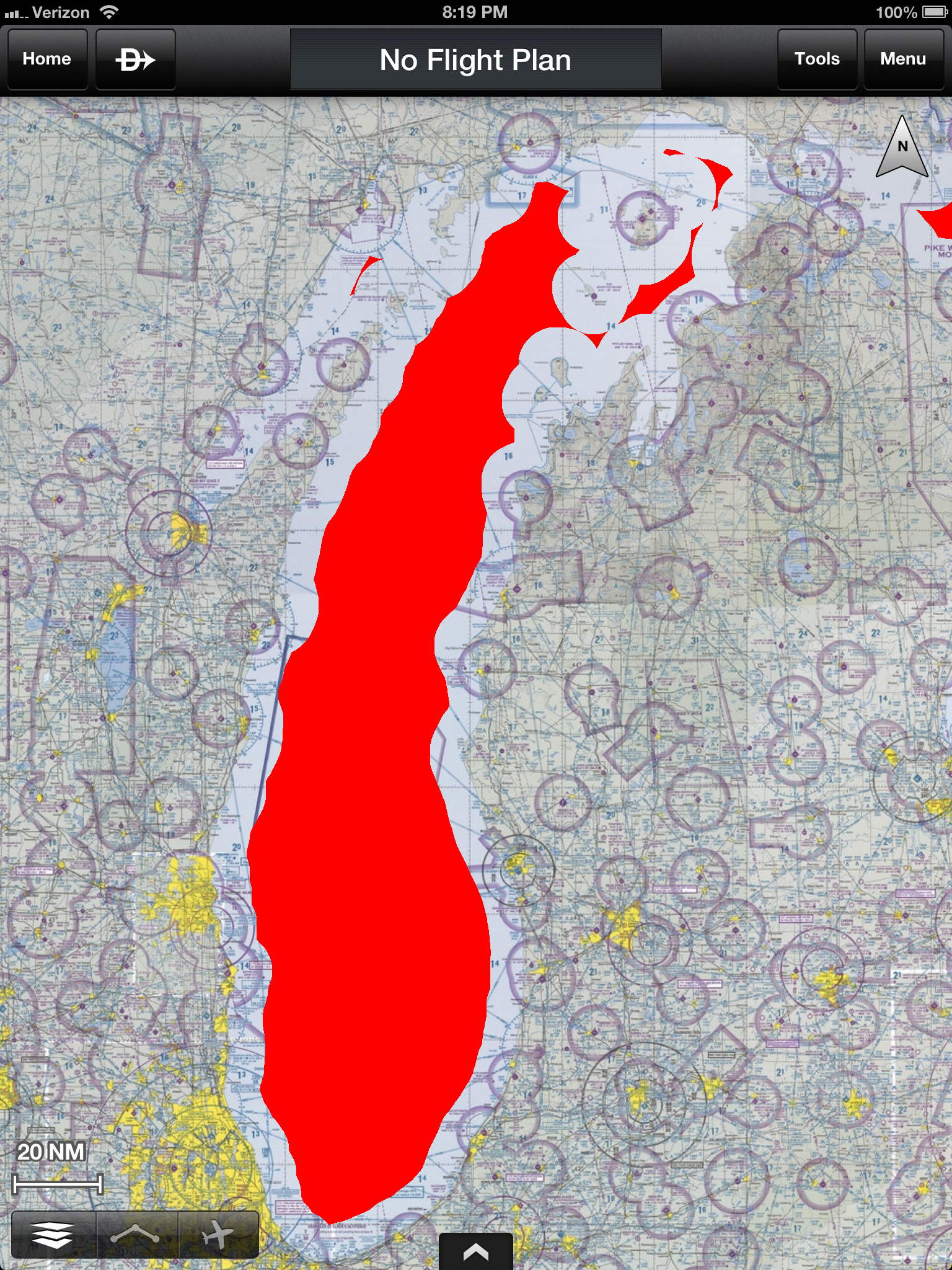
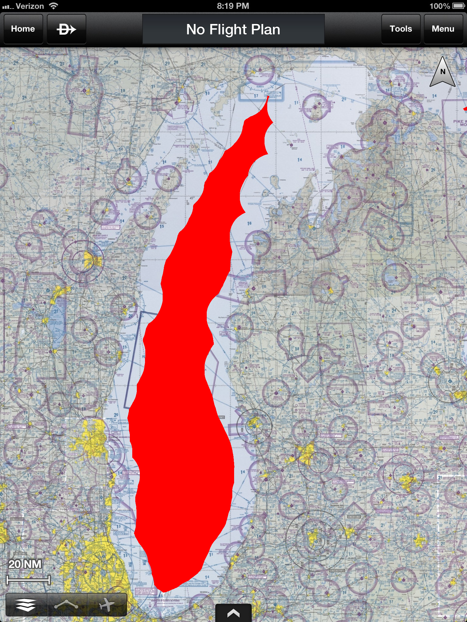
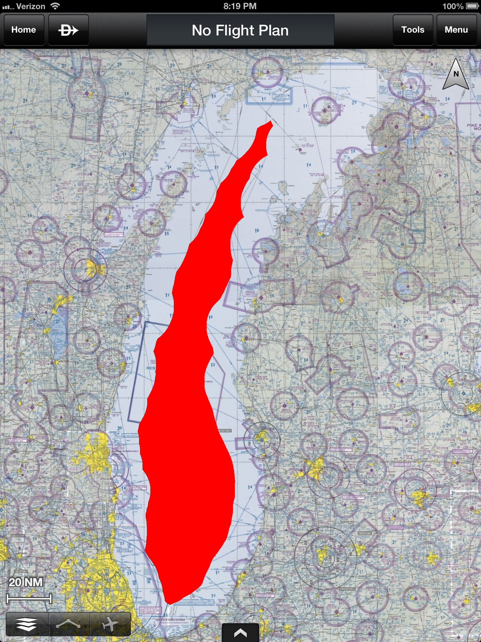
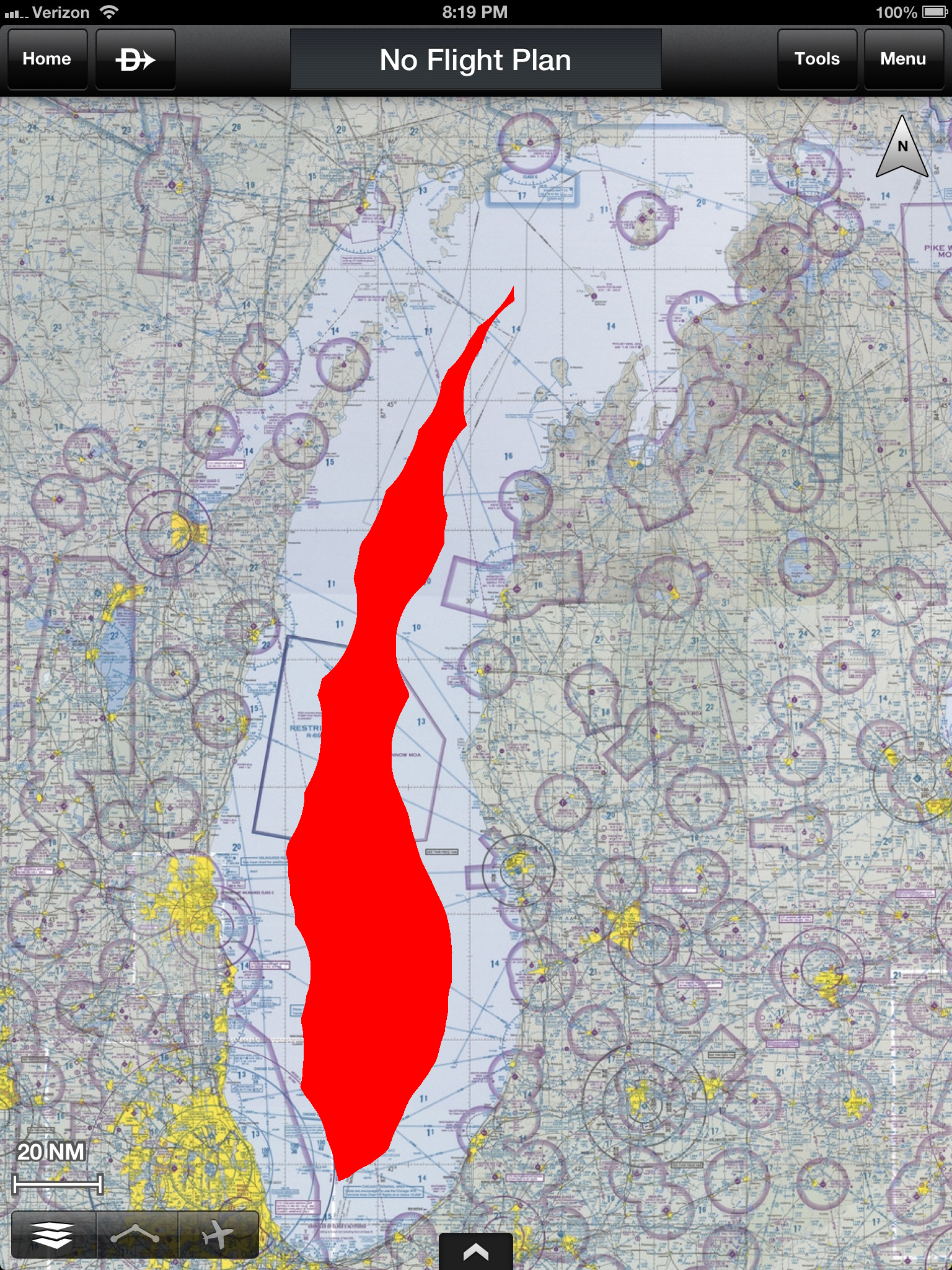
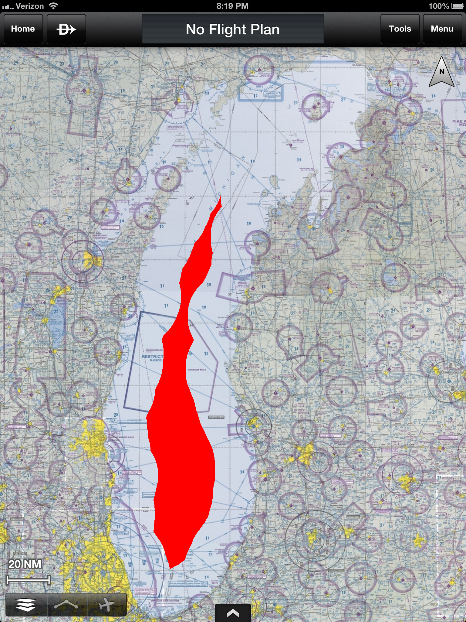
The following maps show how far over Lake Michigan you can fly and still be within gliding distance of land, at various altitudes.
This data uses the glide ratio of a Cessna 172 (1.5 nm per 1000 ft), which also applies to the Cessna 150. The maps assume no wind, and a lake elevation of 577 ft MSL.
NOTE: This map was drawn to a set scale assuming that the scale (6.85 pixels/nm) applies to the entire map. Due to the curvature of the Earth, this causes some slight (~5%) errors. The shaded regions at the southern end of the lake are slightly optimistic (you can't actually glide quite that far), while at the northern end they are slightly pessimistic (you can glide a little farther).
14000 ft MSL (Service ceiling of Cessna 172, and also highest altitude you can go without requiring oxygen tanks)
The results show that you can cross safely at the northern end, because of the strategic locations of Beaver Island, the Fox Islands, and Manitou Islands